
A Geological Guide to your Helicopter trip up the Rift Valley
A recent helicopter trip up the Rift Valley with our friends at Tropic Air was beyond my ability to verbalize or utter, especially on landing, in the moments after each flight. The beauty exceeded the words or the brain and I struggled to make more than enthusiastic grunts and fist pumps when first back on ground. I imagine other passengers are left as inarticulate, dumbfounded by the natural beauty. The wilderness and expanses of land are overwhelming in their gravity. The people too; Pokot in the south followed by the Turkana in the north, possessing a beauty, originality and toughness that is as authentic as the land they inhabit.
For most visitors, the raw wildness, culture and beautousness is enough to justify a great morning cruise. For the Geographical and Geological cases among us though, the heli perspective is next level. Can there even be a better Geological Heli tour on Earth?
We started our own trip traversing the Laikipia plateau, a geological formation that defines our county north of Nanyuki. The plateau was formed 20 to 25 million years ago, a result of the faulting in the rift valley and flood basalts that spilled over the rifts walls. On the fringes of the Plateau a number of gorges cut deeply into the land draining to the rift below, none more dramatic than the Mukatan Gorge on Laikipia Ranching. Down the gorge we wove, windows open to document as much of the speeding scenery as we could. Rich vegetation jumped from the gorge walls and as a result of the recent rains, the river roared below. A feeling that we were descending into Jurassic park was hard to avoid.


Above the valley floor at the bottom we made for a more northerly bearing, moving swiftly over Pokot farmers tending crops and later in drier country herding mostly Goats and Camels. We were now directly above the Rift and the plate boundary it follows. Below us the Somali plate and the Nubian plate were spreading, being pushed apart by plumes of mantle that rise and thin the lithosphere by stretching it and melting it. This same uplift of mantle is what created the Kenyan and Ethiopian highlands, referred to as the Kenyan dome and the Ethiopian dome, respectively. It was these rising domes that slowly dried East Africa making it more grassland and plains-game friendly. It was then this drying that created the conditions that allowed our human ancestors a chance to evolve in the first place. Even the shape and depth shifting Rift lakes below, referred to as ‘Amplifer’ lakes, were significant for us. They are what scientists believe kickstarted our larger brain size development, an adaption to survival in a dynamic and constantly changing environment. We were basically on a tour of our geological source.
After a short period of time we began to see the land rising slowly. As we climbed with it, our pilot Cieran told us about Silale and its significance in the landscape. Silale is an enormous intact Caldera volcano that erupted mostly from 400,000 years ago till 200,000 years ago but had more minor eruptions as recently as 7,000 years back. We landed on the edge to take in the enormous natural architecture of the space. It felt to me like the crater was a mouth pulling me into its vortex like a black hole. Possibly I had had too much caffeine.

The edge of the Silali Crater

Clear water percolating from beneath many square kilimeters of Lava
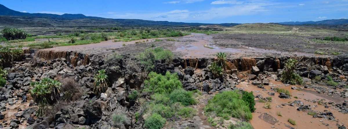
The Sukuta River in spate dropping over a waterfall
As we continued north we moved across enormous expanses of lava flows, much of which had flowed from Silale. From the lava and the Silale hills emerged water that slowly accumulated into rivulets and pockets of sitting water. Birds like herons, egrets and waders were in abundance as were a few large Crocodiles. The water was especially high with all the recent rain and so Crocodile spotting wasn’t as easy as normal but the color contrasts formed by the bright green vegetation and the salt dyed sitting pools were explosive in radiance. The water percolating from the large lava fields and into the rampage of colors and vegetation was crystal clear and gave an impression of the kind of earthly eden our human ancestors would have found here millions of years earlier.

A Tropicair helicopter flying above the Aruba sand dunes
Continuing North we made it to the shores of Logipi, a shallow alkaline lake that receives all its water from hot springs and runoff which floes north up the Sukuta Valley. The saline lake with no outlet, supports enormous numbers of Flamingos who feed principally on the Cyanobacteria, one of our planets most significant and earliest life forms (Cyanobacteria filled our atmosphere with Oxygen as you may remember from Biology. Without Cyanobacteria there is no complex life, no humans, plants or animals, just anaerobic microbes). When we flew over, enormous numbers of flamingoes took flight, their pink contrasting most elegantly with the different tones of browns and greens in the water.
Above Logipi we climbed again tracking the climbing land towards what Geologists refer to as the ‘Barrier Volcanic Complex’ a series of lava flows created by 4 different shield Volcanoes. These extensive flows have been accumulating over the past 1.3 Million years with the last as recent as 1921. These accumulating flows have plugged the valley between Lake Turkana and Lake Logipi, influencing hugely what kind of ecology has been able to evolve on either side of the barrier. The barrier is the kind of place that can enrapture geologists and make them light headed. As a bonus a kind of land structure associated with the stretching land, Horst and Graben features are clearly visible like steps in the hillsides above the barrier. For a geologist I would think it would be transcendental. It certainly was for me.
Beyond the water flows were the stunning Sukuta sand dunes that deserved a stop. A comparison to Dune is inevitable and like the marks left by the giant worms, recent whirlygigs caused by rising air, had left countless beautiful strokes and patterns. Beside the sand dunes stood the dark Aruba Rock, a black lava cone that also conjured something from science fiction. In the far background a bright yellow monolith stood of what I understand to be Volcanic Tuffs, high in Iron and Sulphur. One thing was for sure. It made a very dramatic hillside as we passed it by.
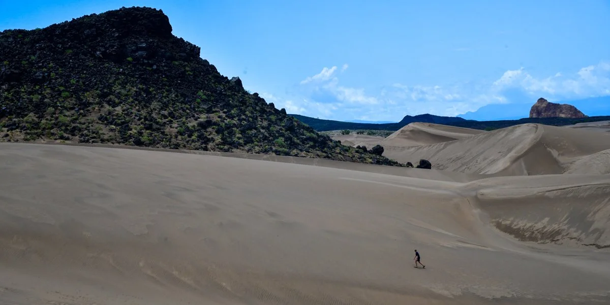
Aruba rock behind Rufous exploring the dunes.
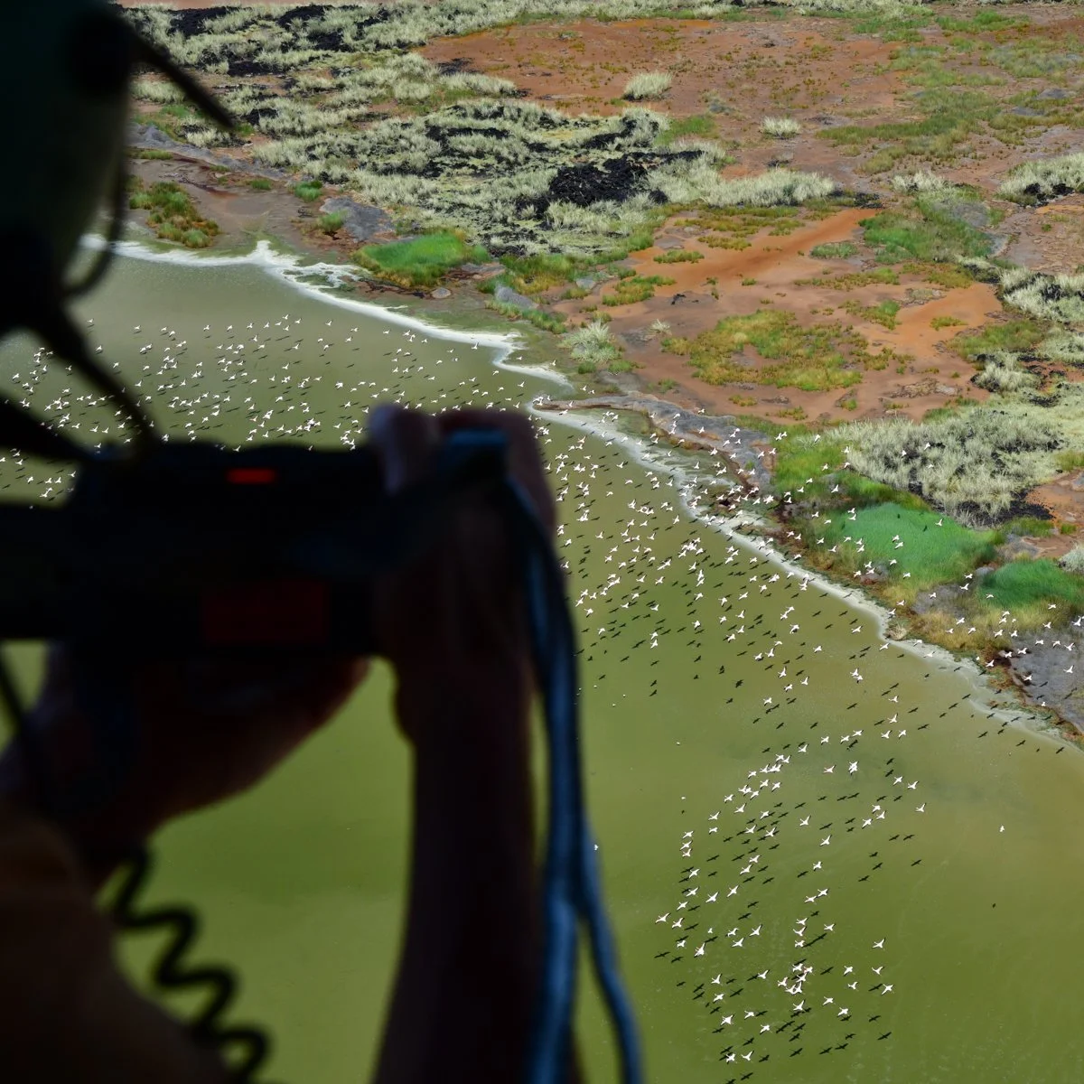
Flamingoes flying above the Lake Logipi
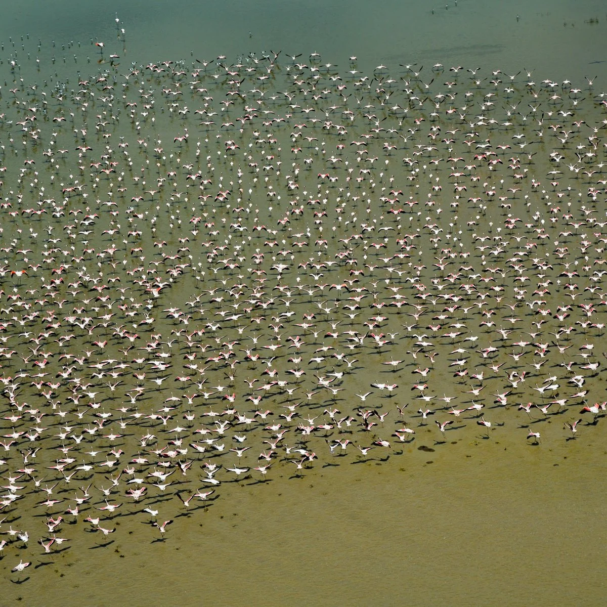
Lesser Flamingoes in Logipi
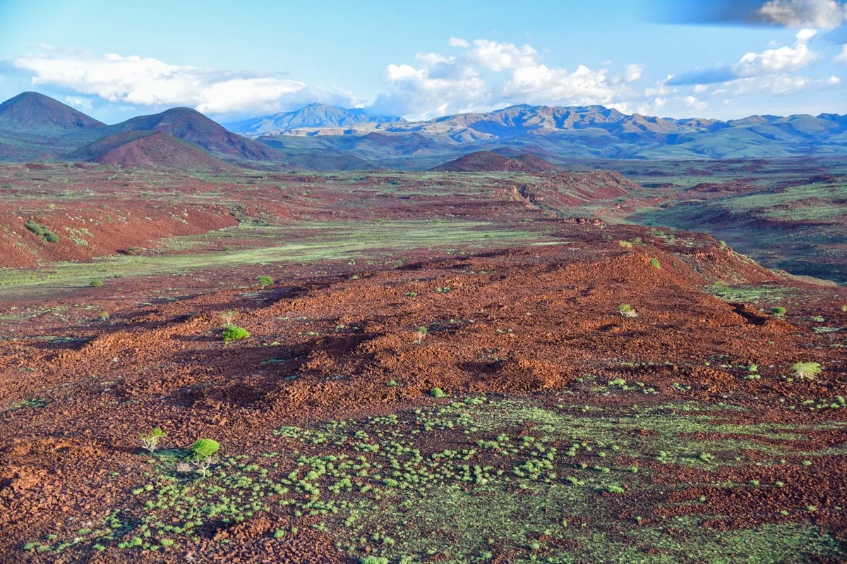
A good example in this area of the Horst and Graben step structures produced by the stretching Rift Valley.
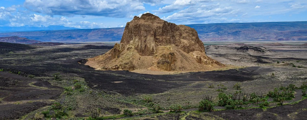
Beyond the Barrier you might pass the dramatic Nabuyaton Crater, an adjacent part of the complex but with a beautiful symmetry beside Lake Turkana. The lake itself is a geologic wonder unto itself and is worth a lifetime of exploration (and certainly another blog entry) but we turned toward Koros Camp at this point, a most excellent comfortable camp (run by wonderful people, Amory and Korina) that can accommodate travelers by heli, road or fixed wing. It should also be pointed out that for those that are continuing back to Nanyuki or Laikipia that the pilots might recommend going back via the Mathew’s Range and the Ndotos should the weather permit. This return is as jaw dropping as the trip up the rift. What a highly recommended trip this is.

Chopper fun with Tropicair